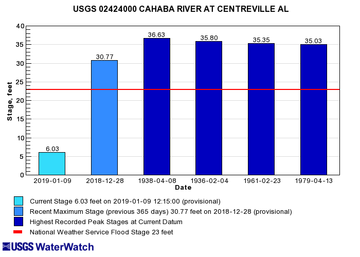
Via waterdata.usgs.gov — The Cahaba River at Centreville: today vs. Dec. 28, 2018, vs. record floods.
According to the USGS Water data, the Cahaba River didn’t set any records when it breached its banks on December 28, but looking at the chart from today you can see just how much higher than typical it rose. More dramatically, you can see the water there and not in the photos below. I tried to replicate where I was standing and reproduce each frame as close as possible, but it was slightly disorienting having only the trees as anchor points. The water level was so different that it felt almost like I was in a completely different spot on the river. Also, I used my phone for the flood photos versus my actual camera for the photos this week, thus the color and detail discrepancies.
31 feet versus approximately 8.5 feet (on Monday, the 7th). Take a look below and then comment to share your story of the December flood.
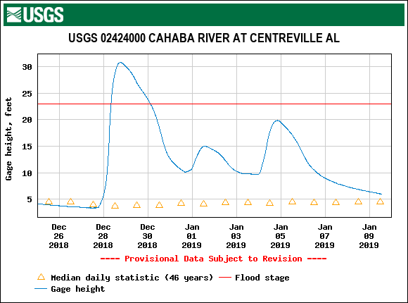
via waterdata.usgs.gov — This graph shows the peak of the recent Cahaba flood at Centreville, on Dec. 28, compared to where the river was on Jan. 7 when the comparison photos below were taken. 31 feet versus approximately 8.5 feet.
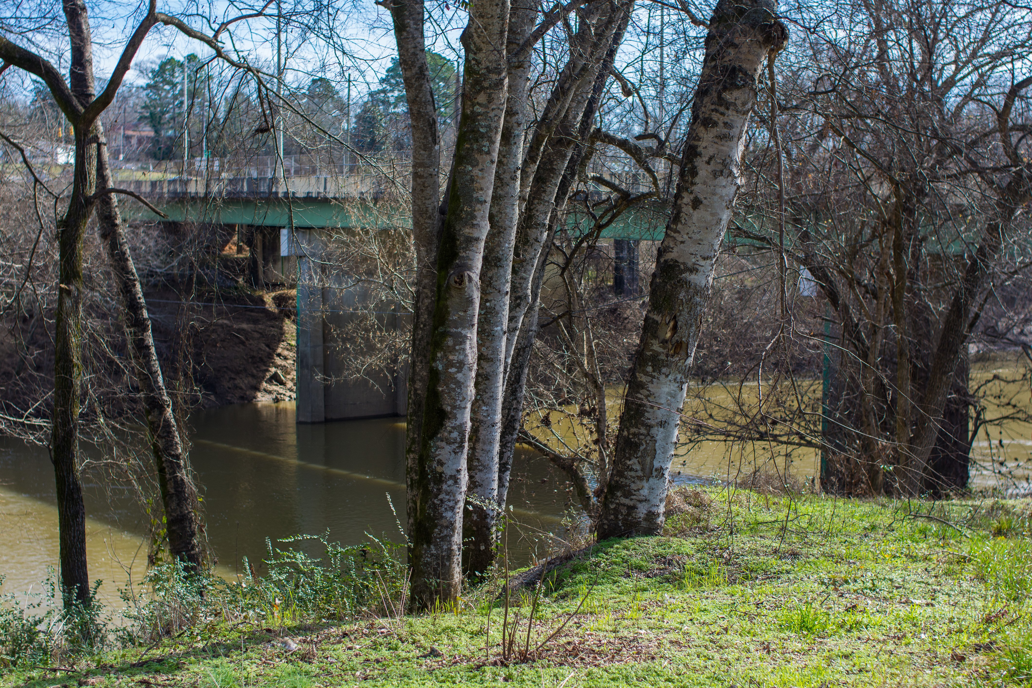
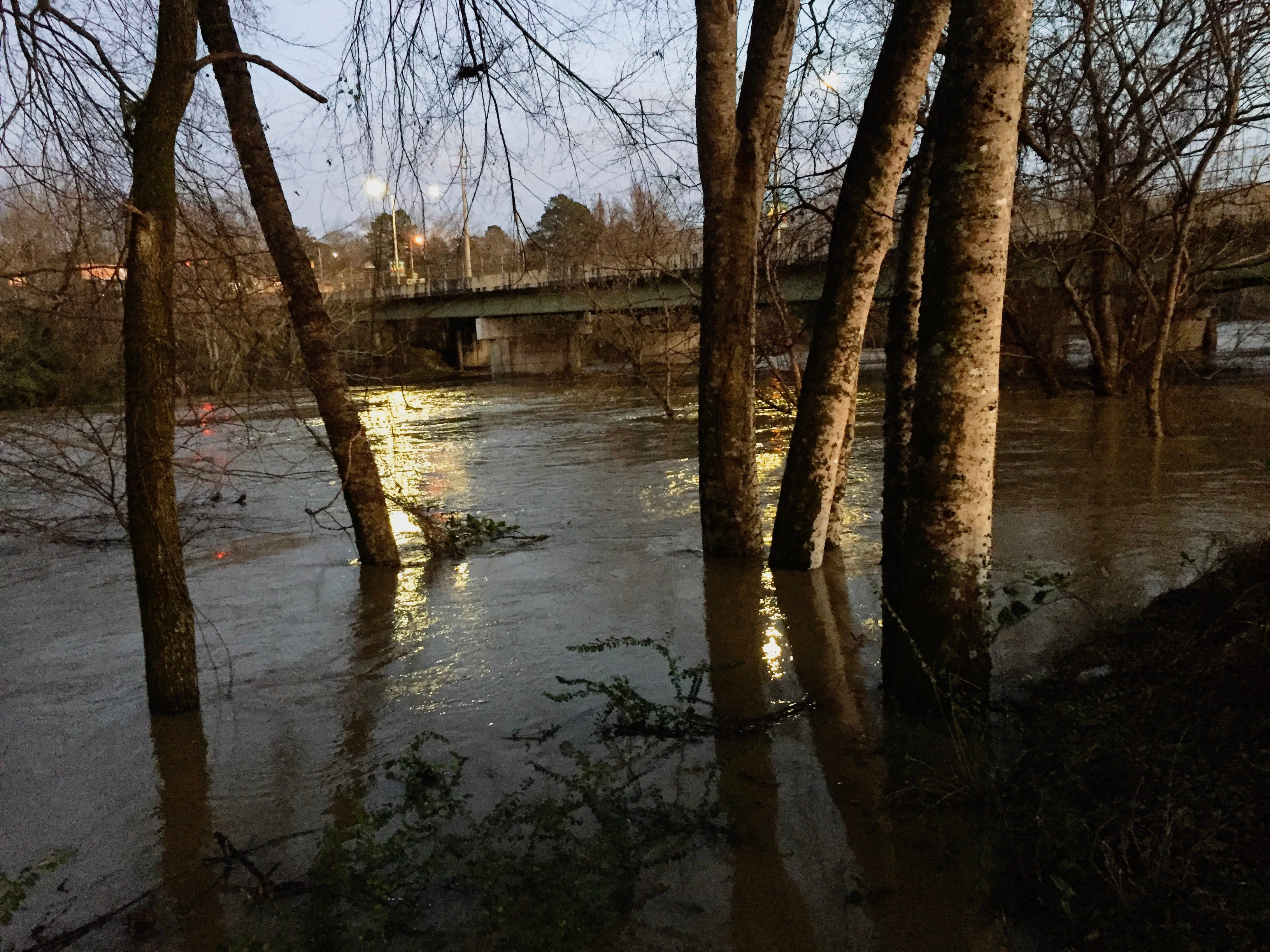
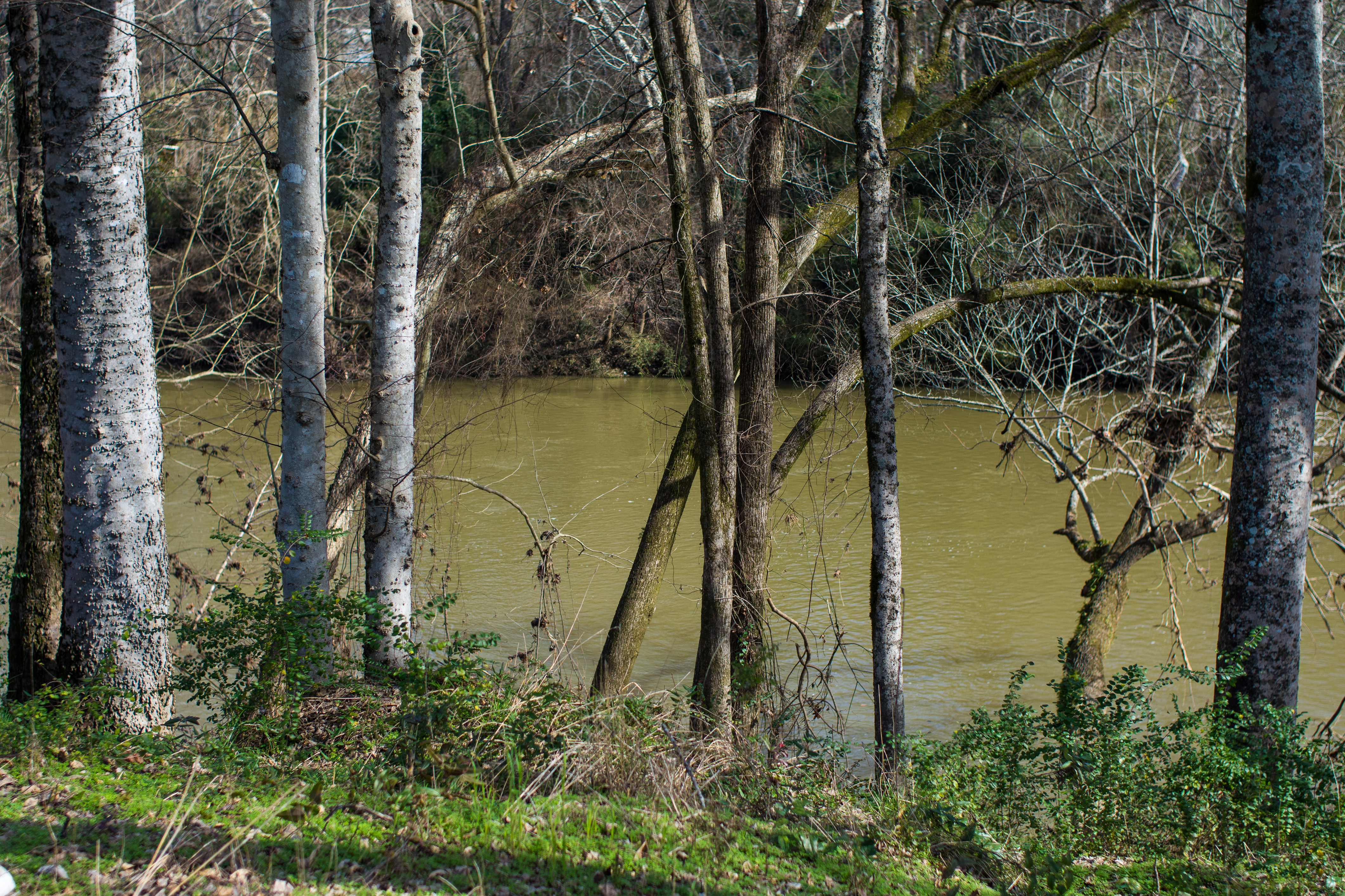
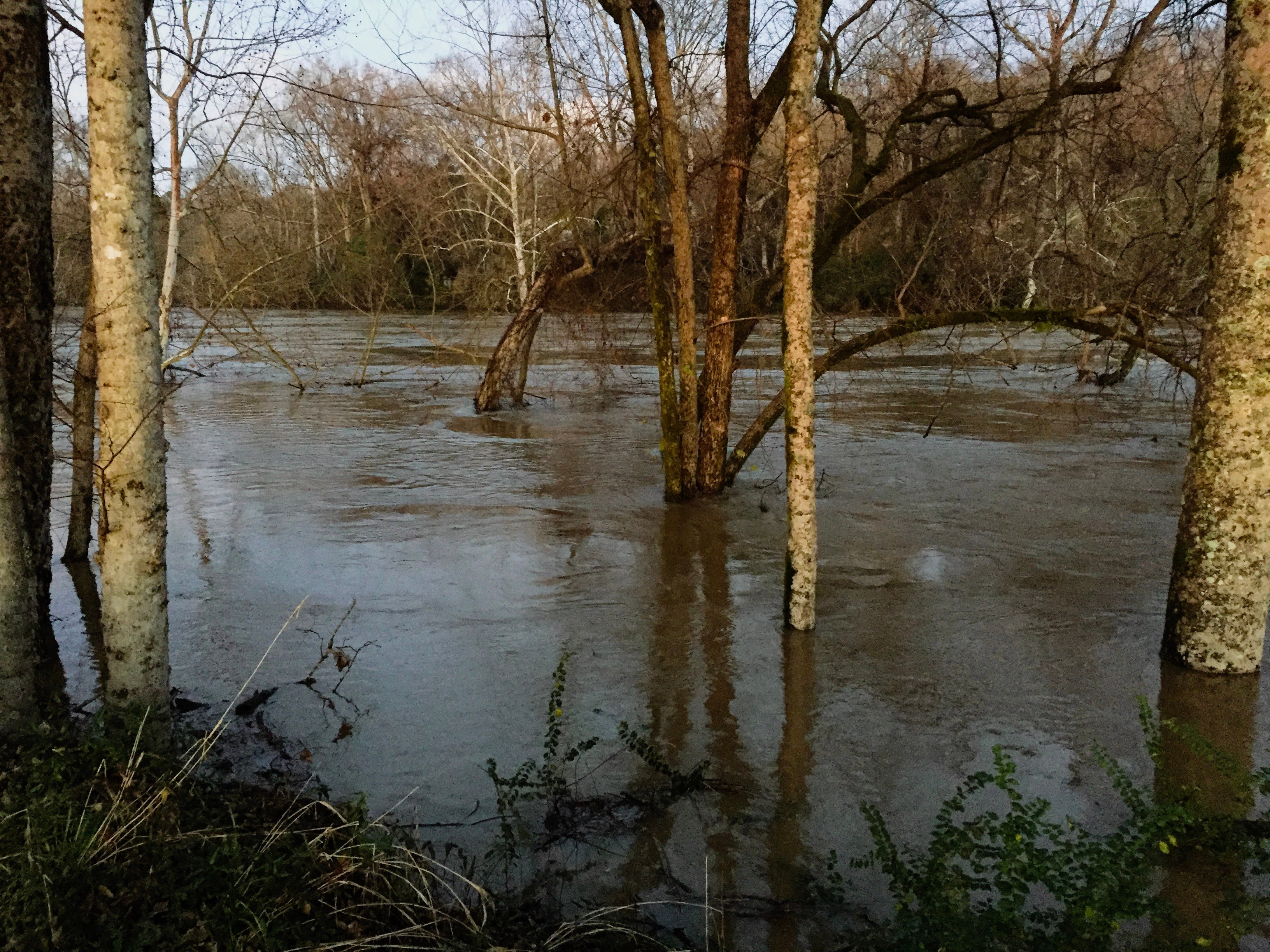
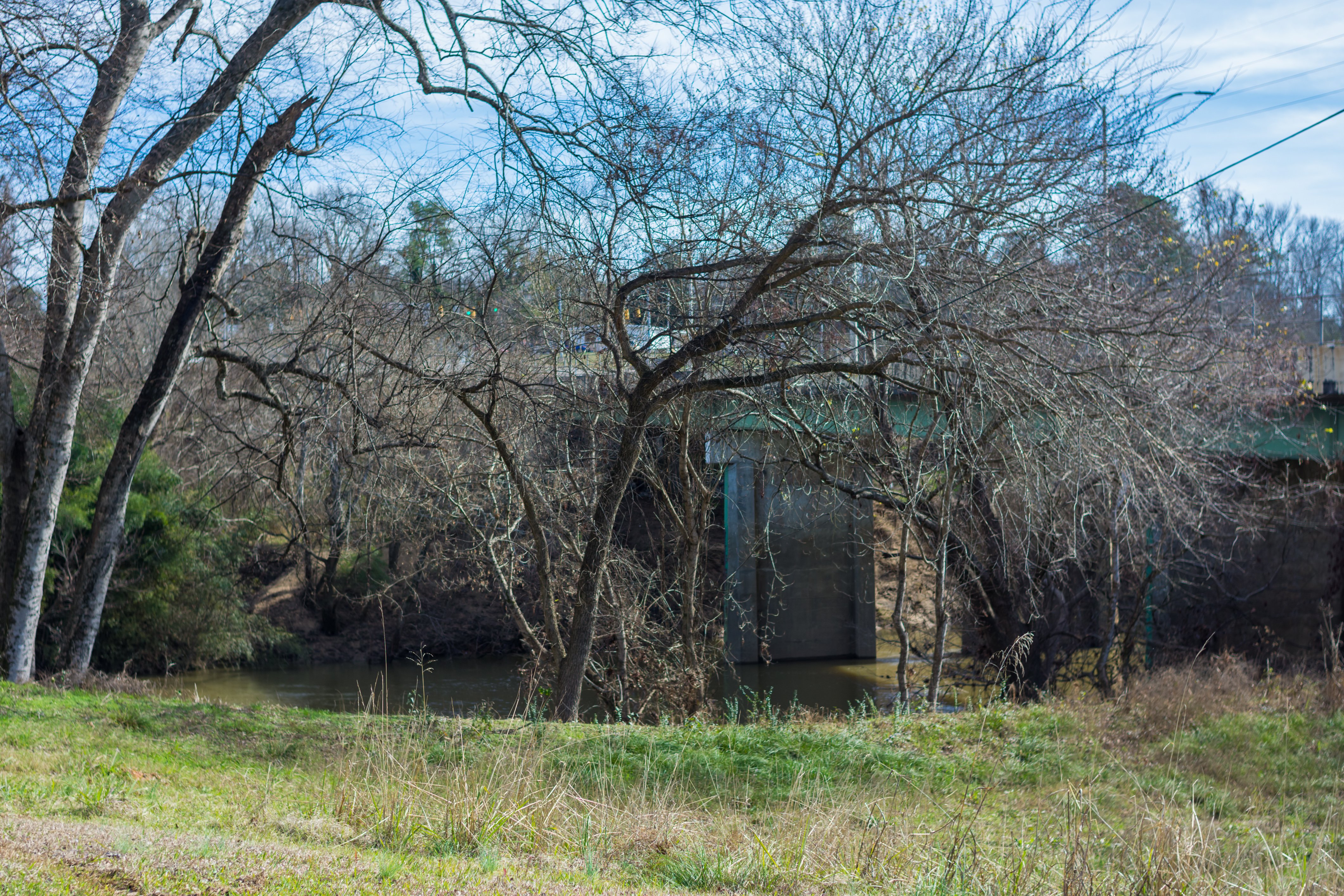
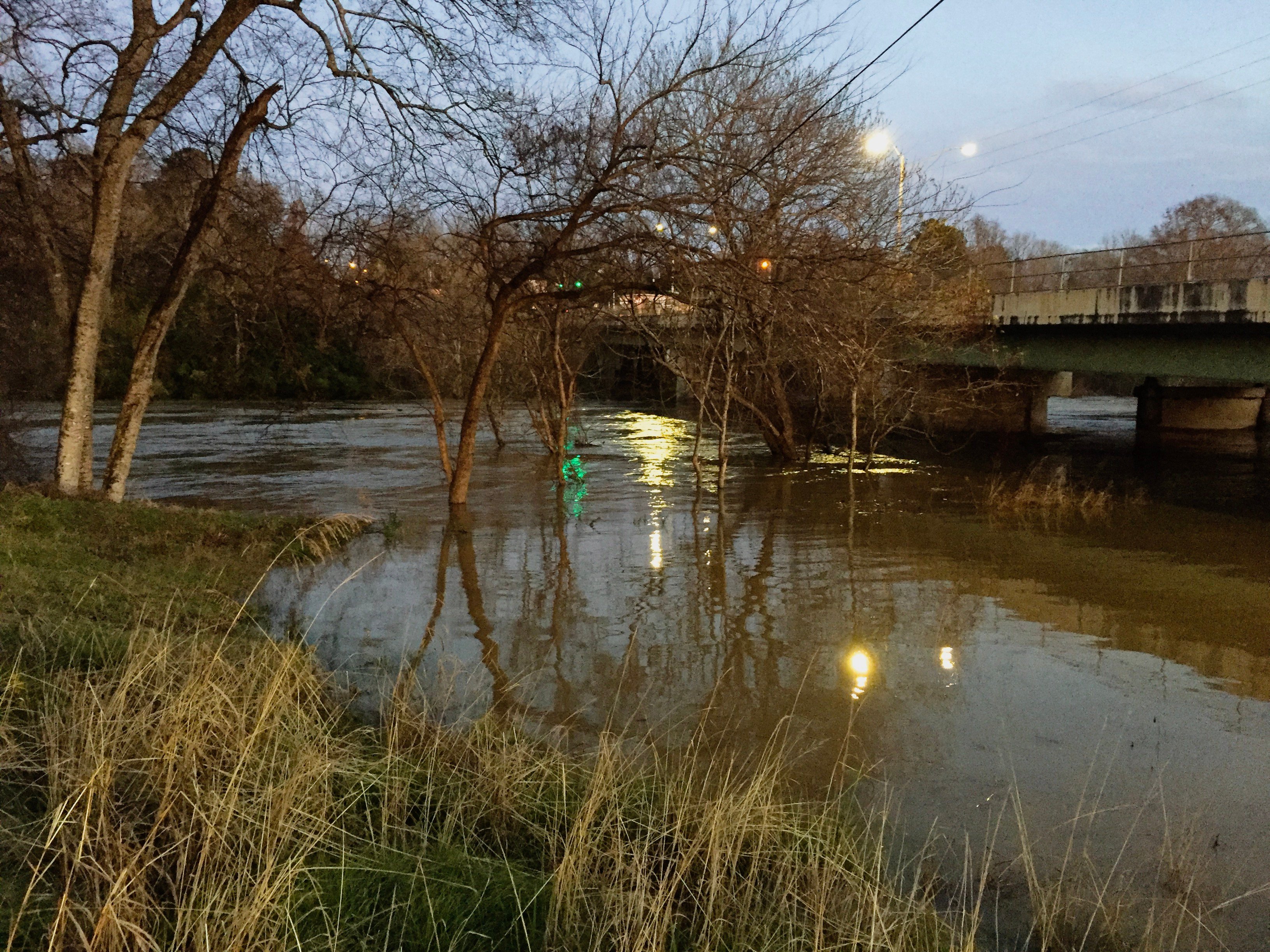
All photos below were taken from the edge of the Bibb County Chamber of Commerce parking lot, just west of the river bridge on Highway 25 in Centreville.
VIEW 1 – Photo by Jeremy Crowson/Bibb Voice. The Cahaba after the waters receded, on January 7.VIEW 1 – Photo by Jeremy Crowson/Bibb Voice. The Cahaba during the peak of the flood, just before sunset on December 28, 2018.VIEW 2 – Photo by Jeremy Crowson/Bibb Voice. The Cahaba after the waters receded, on January 7.VIEW 2 – Photo by Jeremy Crowson/Bibb Voice. The Cahaba during the peak of the flood, just before sunset on December 28, 2018.VIEW 3 – Photo by Jeremy Crowson/Bibb Voice. The Cahaba after the waters receded, on January 7.VIEW 3 – Photo by Jeremy Crowson/Bibb Voice. The Cahaba during the peak of the flood, just before sunset on December 28, 2018.


